False Alarm, Lotus, & Crosswind
The nice RiverKeepers lady said they'd heard reports of a bad runoff into the James near a town called Howardsville and the Rockfish River. I'd planned just to fly around for a little while, but this seemed more fun--a mission--so I found the place on the map and plotted a course: 308 magnetic and 57 nm. There's nothing en route but woods and a few farms, so as usual I decided to navigate by pilotage--looking at the ground and the map--and use the GPS as a backup. The wind at 3000 feet was forcast to be from 220 degrees at 15 knots.
At the airport, the wind was 230 at 12, a direct crosswind on runway 15-33. Well, I can handle that, but it's probably going to be a bit bumpy aloft.
It was bumpy aloft. There was also enough headwind component going out that the Cessna 172's 110 kts airspeed never got above 90 kts groundspeed on the GPS. I tried 2000 feet, but it was bumpy, so I went up to 2500 and then to 3000. The wind was stronger there, but smoother. Unfortunately, that's where the haze got thick, so I stayed right there, as a compromise among turbulence, headwind, and visibility. At first I flew at 2500 rpm, but cut back to 2400 when I noticed that the oil temperature was just below the redline.
In 38 minutes I was at Howardsville. Found the James River, found
the Rockfish River. The James is the bigger one. This is looking
east, with the sun behind me so that the haze wasn't lit up so much.
This is the same view, but looking northeast.
Maybe the offender was that newly cleared spot in the lower
left, baut in any event I didn't find any sign of crud emptying into either
river. Didn't see any wild geese, but decided it was a false alarm
anyway.
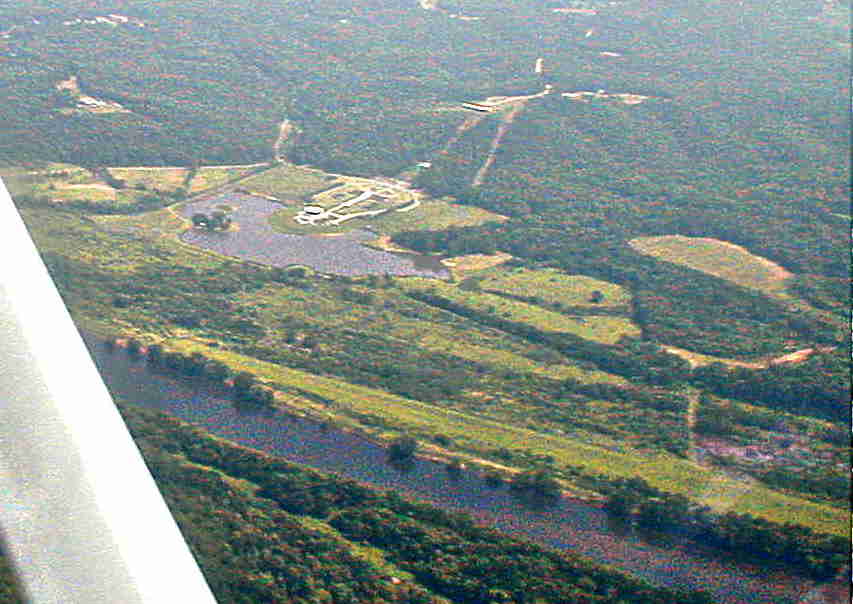
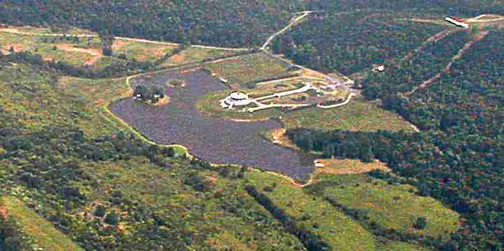
So I turned south and flew a few miles to Lotus International. Yep, really. This is not an endorsement--I don't know anything about them at all. I just noticed their private airfield on the sectional chart right near Howardsville and got curious. It's a grass strip running right along the James, at the bottom of this photo. The white thing is a big lotus-shaped building in front of a pond. There's another large building beyond it, on top of the hill.


Here it is again. These pics are heavily doctored, by the way. I tried to show the shape of the white Lotus-shaped building, but you'll have to use your imagination. Or try to see what you can figure out at their homepage http://www.yogaville.org/confcen.htm Frankly I found it underwhelming--but then I find more enlightenment in an airplane or a smile than from contemplating lotuses. (Lotus root is good to eat, though--had a lot of it while living in China. And my wife gave me a ring bearing the inscription, Om mani padme hum, which is sometimes translated "The jewel is in the eye of the lotus." But it's also translated many other ways--which suggests to me that it means everything--or nothing. I like the ring, though. But, then, I'm a nothing kind of guy. And the big, white lotus-shaped building seems almost as incongruous in the central Virginia farmland as that big, white concrete mosque does in the cornfield just off I-75 south of Toledo, Ohio.)
On the way home with some of the wind at my back, the GPS indicated
130 knots. Back at the airport, the AWOS said the wind was 230 at
15. Well, that will be interesting. On short final I was crabbing
about 25 or 30 degrees at 65 knots. I suppose I ought to be able
to work out the actual wind velocity easily. Instead, I'll just say
that I had the left rudder pedal almost all the way down, but the landing
went quite nicely. I used 20 degrees of flaps and kept the speed
at 65 kts until right down on the runway. A gust lifted me up slightly,
but passed and there was no need for power. After I shut down on
the ramp the windsock was standing straight out, at right angles to the
runway. Later I checked the METAR for KRIC, a few miles away, and
found that it was 22016G20KT at that time. (That's short for "The
wind is from 220 degrees at 16 knots, gusting 20.")