Around The World
In One Day
Circumnavigating
RIC
01-01-01. This first day of the millennium seemed an auspicious one to fly completely around the world.
Given that the center of the world coincides with where I happen to live, it seemed reasonable to fly all the way around today.
So I booted up my trusty E6-B Whiz Wheel flight computer and--keeping in mind the programmer's maxim Garbage In, Garbage Out--proceeded to enter the relevant data:
(1) Cruising speed (C-172) = 100 kts.It turned out that the world today was approximately 64 nautical miles (NM) in diameter. I studied the sectional chart and noticed that an airport was located at each of the four corners of the world--and that they lay at the cardinal compass points.
(2) Unencumbered bank balance / aircraft rental cost per hour = 2 hours.
(3) C = pi d.
(4) Solve for the size of the world.
However, I still had to factor in the distances between the cardinal airports, plus 5 minutes per airport for landings and a few more minutes for flying around gawking. Those factors enabled me to determine that today the distance around the world was going to be precisely 84 NM (approx.).
At FCI I fired up N12902 and flew directly to PTB at the southern corner of the world.
I stayed low in order to see the world as clearly as possible. There was essentially no wind below 3000 feet, and the air was smooth as honey. The vislbility was good--especially down low--and all was right with the world on this first day of the millennium.
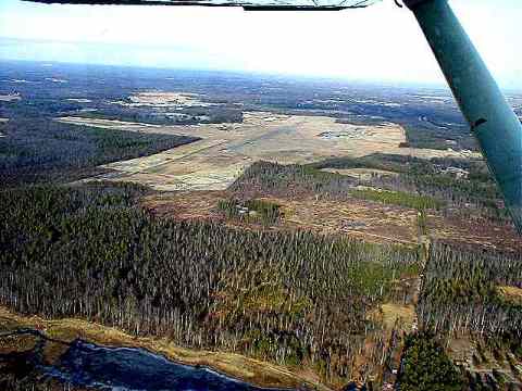
I crossed PTB at 2000 feet, the highest I flew all day, except for a minute at the end, decended to 1000 feet, the pattern altutude, and turned right to enter on the 45 for downwind for runway 23. This photo is looking from the south toward runway 05.
(PTB is now Dinwiddie County Airport, by the way, not Petersburg, although it's still PTB on the charts.)
I did a touch-and-go and then flew northeast at 1500 feet--about 1200 feet above the ground--toward the XXX VOR. That course made the world slightly larger in circumference, but it allowed me to stay well clear of Richmond International's Class B airpace--and that allowed me to fly along without having to talk with anyone except near the airports at which I intended to land.
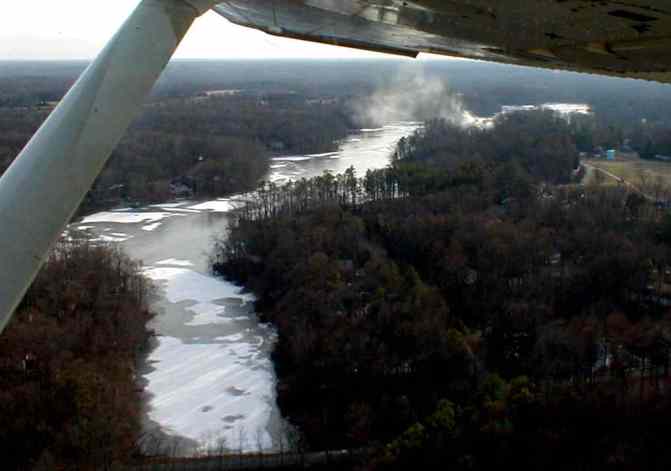
I flew across the James River just east of the bridge. I suppose it would have been more prudent to climb a few thousand feet higher, in case of engine failure, but I decided that the better view at 1500 feeet was worth the slight risk of a cold swim.
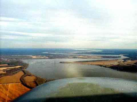
The James winds away to the
east like a flat grey snake.
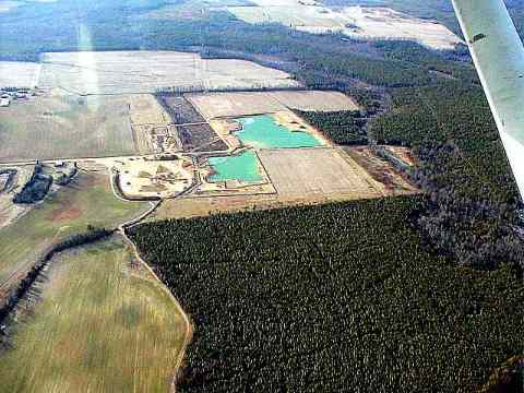
At the Hopewell VOR I turned
north and flew low over farms and a few houses. And over thses bright
green ponds. What makes that water so brilliant? (Not
sure I want to know.)
The New Kent County airport is at the eastern corner of the world. Staying below the 1400 foot floor of Richmond's airspace, I got into the pattern and landed heading east on runway 10. Like PTB, the place seemed deserted. No one had responded to my radio calls to UNICOM, and I heard no other traffic.
I took off (above, looking back) and headed north northwest across the Pamunkey River, with fog rising from it, and on to have a look-see at a new ultralight park that I'd read about in the newspaper.
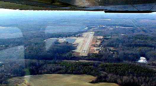
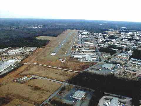
Then it was time to turn west toward OFP, Hanover County Airport. On the way I spotted two private grass fields and circled the area where a friend lives--although I couldn't pick out his house.
I've been in and out of OFP
many times in the front seat of John Greenwood's Pitts S-2A while taking
aerobatics lessons. But John won't let anyone land the Pitts, so
I had never actually landed there. John always took the controls
on downwind. Today's landing in the 172 Spam Can, as John calls
them, with its tricycle landing gear, was smooth and easy. But today,
even the Pitts with its long nose in the air would have to have been smooth
to land.
Leaving OFP, I flew southwest to the campus where I work. Finding it among the office parks and suburbs wasn't as easy as I'd expected, but I finally was able to locate it and take a couple of photos.
My original idea was to fly about 20 miles west to Holly Springs, a private ultralight and general aviation airpark, but that was off the edge of the world today, so instead I flew to my own neighborhood and tried to photograph the house. It's surprisingly hard to photograph a small house in a wooded neighborhood (even in winter), while at the same time flying an airplane between 1000 feet above the ground and 1400 feet above sea level when the ground is already at 250 feet.
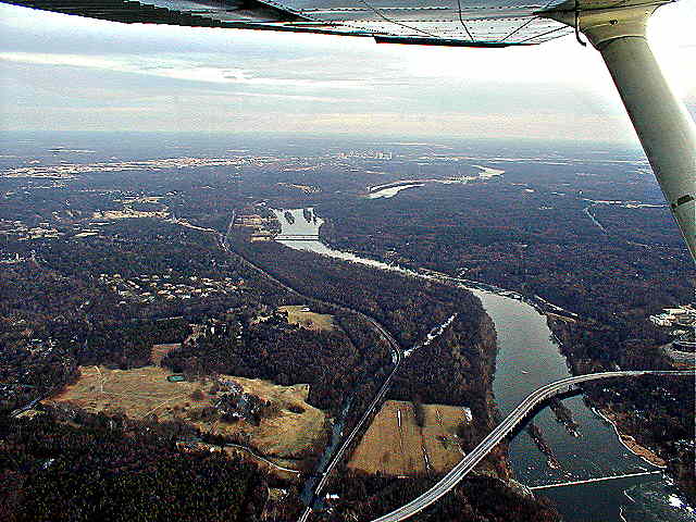
There I was three-quarters of the way around the world and my credit card was beginning to vibrate in my pocket, so I headed south across the upper James River toward FCI. This is looking east from the western edge of the world, with the James flowing toward the fall line and the tall buildings in downtown Richmond just below the horizon and north of the river. That's the Ed Wiley Bridge and Bosher Dam in the foreground.
South of the river I decided to see what the world looked like from above 1500 feet, so I climbed to 4000. The world looked very flat and bland at 4000 feet, and the air was slightly hazy up there. Tsk. So I pulled on the carb heat, brought the throttle to idle, and did all the forward slip the 172's rudder would allow, coming down at better than 2000 feet per minute.
Landed at FCI, had a nice chat with the gas guy about this 172 and the FBO's other one. We both agreed that this one flies beetter. But no airplane could have flown badly in this cold, smooth, clear air.
And that's how I flew around
the world today. The world was absolutely lovely and I came back
feeling elated.