Photo Mission
&
well, where IS it ???
Today's mission (as John Greenwood likes to say) was to be an attempt to photograph our neighborhood and some other places before the leaves come out. (The leaf canopy is so solid in summer that our house is completely invisible, except from a 45-degree angle to the west.) Then we'd fly west to look at a house that Carol and I had looked at on the ground a few days ago. The house has just enough cleared land for an airstrip--a sloping one--but the asking price is so high that this was really just an academic exercise. Then, if there was time, we'd fly farther west to look at another piece of land.
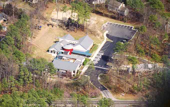
Okay, son Chris met me at the airport, and soon we were up and away. Chris did the camera work--and did it nicely. Here's one example, the Richmond Montessori School, where he and his brother Jon went to school most years until they were 12, or so.
We were at about 1,000 AGL. The camera was a 35 mm SLR with a 70-200 zoom lens, with Kodak ISO 200 print film--not that you can tell any of that from this lo-res jpg image.
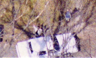 If you look
closely at this one on the right, you might be able to discern a family
friend, William Johnson, standing beside the 1986 Lincoln he'd just bought
for $400. He has on a white jacket over a black shirt and is waving
at us with his right arm. Behind him, in line with the left front
fender, is Carol--blue-grey top and light grey pants. This image
is about half an inch wide in the 4 x 6 inch print. The mottled appearance
is caused by the grain of the film. We were again at about 1,000
feet AGL for this shot. It illustrates how hard it is to pick out
humans on the ground, even at that relatively low altitude. Neither
Chris nor I saw William and Carol.
If you look
closely at this one on the right, you might be able to discern a family
friend, William Johnson, standing beside the 1986 Lincoln he'd just bought
for $400. He has on a white jacket over a black shirt and is waving
at us with his right arm. Behind him, in line with the left front
fender, is Carol--blue-grey top and light grey pants. This image
is about half an inch wide in the 4 x 6 inch print. The mottled appearance
is caused by the grain of the film. We were again at about 1,000
feet AGL for this shot. It illustrates how hard it is to pick out
humans on the ground, even at that relatively low altitude. Neither
Chris nor I saw William and Carol.
Then the silly part began. I flew west toward the GPS waypoint that I'd set when we visited the house by car. We got closer. And closer. And finally the GPS said we were right THERE. Yay!!!
Unfortunately, I couldn't spot the place. I flew around the waypoint several times. Once I caught sight of a bend in the road that I recognized, but still couldn't pick out either the house or the 15 acres of mostly cleared land it sits on. Nor could I pick out the house next door, where some acquaintences of ours live. And I still can't quite understand why I couldn't identify the place. Maybe "selective variability"--the random errors that the Department of Defense introduces into the GPS signals. They can throw a fix off by 100 meters, or so, and it's possible that two errors in opposite directions doubled the error to 200 meters. But even so, I really thought I should be able to identify that place. Nope.
Finally we gave up on it--and on finding the other place, as well.
We flew up the river and then headed back to the airport, where I did a
couple of touch-and-goes and then a full-stop landing.