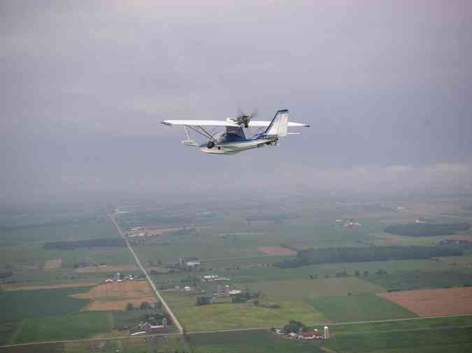
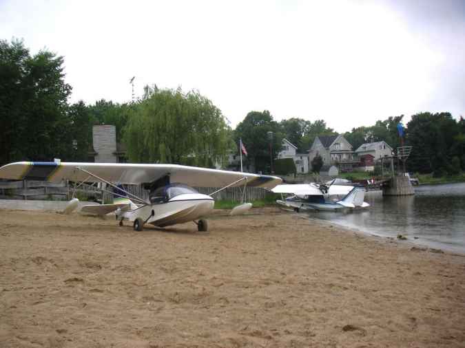
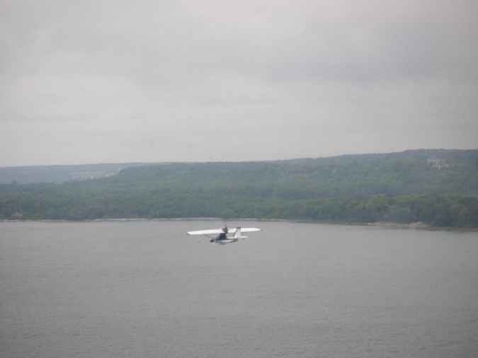
Lesson 214
2004 July 30
5.2 hours


I haven't posted any "Lessons" for a long time--not for lack of material, but because I've just been too busy flying my SeaRey to write about it.  It has flown 225 hours now (late August 04), including the 5.2 hours that this Lesson describes.


Lake Michigan Adventure
A Viking Voyage


Despite the wailing of the women and the gnashing of teeth of the trepid flyers of land-planes, the dauntless Viking, oft-praised in sagas, and the nescient scion of the Border Reivers boarded Boats guided by the Volunteers and were ferried across the Guiness-dark waters of the Lagoon to their sturdy SeaReys, long-anchored among the Lillies and impatiently awaiting the coming Flight to the North Country.

Alas, the gods of the Wind and Weather had become offended by the incessant delays brought about by the Volunteers, who had seemed loathe to spring into action until the Viking waxed wroth with them and at last they applied their considerable skills to the Mercurys and delivered the two Adventurers to their Flying-Boats, then towed them from the safety of the Lagoon out into the oft-treacherous Lake Winnebago for their departure toward the North.


Wait a minute here.   If you're a landplane pilot reading this, my advice to you is to stop. right. now. and go get yourself a seaplane rating.   Then build a SeaRey and learn to fly it.   Otherwise you're probably going to turn as pale as the chill fog upon the warm waters.  

And if you're already a SeaRey pilot, please keep in mind that it IS a flying boat--that is, a boat that can fly--and not merely an airplane that can float.   Otherwise, this story might give you the willies.  There will be a few other caveats and cautions at the end, as well.


All right?   Now let's get back to the story--but a simple, modern telling of it from here on.

I had flown my SeaRey from Richmond, Virginia, to the big annual "AirVenture" airplane thing at Oshkosh, Wisconsin (with overnight stops on the way  on the Ohio river near Cincinnati and Quincy, IL).  I camped at the AirVenture seaplane base and enjoyed the big show for several days.  But all too soon it was time to leave.  I was going to visit friends on Beaver Island, at the north end of Lake Michigan, and then meet Carol, my wife, near Detroit before flying on home to Virginia.  In all, it was a 2000 nautical mile trip.

Oshkosh Seaplane BaseHere's the Oshkosh seaplane base the evening before this story begins.  The view is to the southwest.
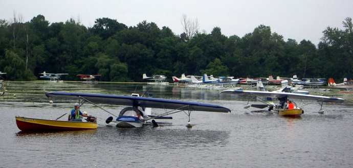
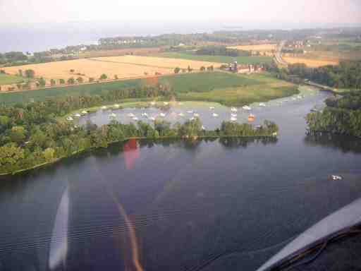
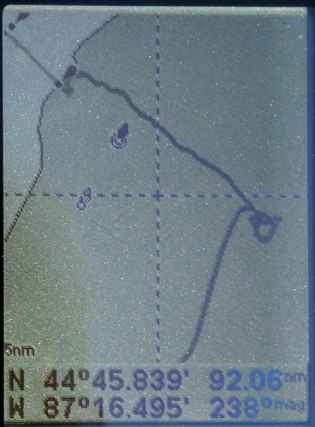
The bay in the foreground opens into Lake Winnebago.  The lagoon, where the seaplanes are tied to buoys, is protected from wind and waves.  The seaplane base proper is to the right of the lagoon, and the campground is in the trees at the upper right.

The Viking lives in Michigan's U.P. and has the rep of being fearless and intrepid--and successful--when it comes to feeling his way along lake shores and rivers in weather that would ground everyone else.   We checked the weather and figured we had a two hour window to get out of the seaplane base and north of Green Bay.   After that, the forecast was for clear skies to the north and the proverbial pea soup for OSH and points south.   We made ready.  

Unfortunately, the volunteers at the seaplane base were busy and we didn't get boated out to our airplanes until the two hours was just about up.   Here we're being towed out through "The Gap" to the bay.

SeaReys being towed out of lagoon

We took off and headed east across Lake Winnebago, figuring that we'd see what we could see, and if we couldn't see enough, we'd either come back or land and wait it out.   There was almost no wind, so we knew the lakes would be smooth enough to alight upon.

This is the Viking approaching Lake Michigan.   The water is beyond that line of fog--although it looks worse here than it was in reality.  We could see the lake clearly from this position, but the camera couldn't.  (A haze filter would have helped.)

SeaRey flying toward Lake Michigan

We also knew that the fog and haze was a rather narrow band lying diagonally across our intended course.  The Viking and his wife had been talking over ham radios as she was driving home and she reported that the sky was bright blue not far to the north. 


THIS IS IMPORTANT:  We were a lot better equipped and prepared than it might seem.  We had looked closely at the weather before taking off--especially satellite photos of the area that showed the cloud cover.  In addition to the ham radio, the Viking had a marine band radio and a depth finder.  We had three GPSs, and as always we were wearing inflatable PFDs.  And we had a clear plan, with alternatives that we had already thought out.  AND we were in flying boats, so we had many more alternatives than any landplane pilot ever has.


We crossed over the line of fog and turned north, flying parallel to the shore, a mile or so out and at about 500 feet, in reasonably good visibility.  Eventually, however, we would need to get back around the north end of the fog and the line of clouds that lay above it, so we flew on, paying close attention to the ceiling and the visibility, not wanting to get into IFR conditions.

After about 15 minutes it became clear that the clouds and the fog were merging to the north of us, and we weren't going to be able to get around them without crossing all the way over to Michigan--about 50 miles across Lake Michigan at that point.   We didn't want to do that because it was far out of our way.   We could have turned around, but that would have been going back, and we didn't like that idea, either.  Besides, we knew from the Viking's wife that the sky was already clearing ahead and that the translucent stuff was moving in our direction.

So we landed on Lake Michigan to wait it out.   The Viking went first.   He set down, landing into the light wind, but had trouble with the swells, which he said were about five feet high--there were no short-length waves because the breeze was light. I tried it next, but after two WHAMs on the swells I powered up and turned parallel to them.  That time the alighting was easy, with no problem from the light crosswind.   I simply settled in on the crest of a swell and rode along it until falling off the step.   Then I had to locate the Viking.   Did a 180 on the water and spotted him about a quarter mile away, just visible through the approaching fog.

We floated there for about half an hour with the engines shut down, chatting on the radio and hoping the fog would clear away soon.   But it just got thicker, and eventually we decided to taxi to the Sturgeon Bay Canal inlet.   The Viking has a buddy there and we figured we'd tie up, find him, and go to lunch.

We taxied in displacement mode for about 5 miles.  Here's the Viking leading the way:

SeaReys on Lake Michigan in fog

The photo gives an idea of our RVR just then--the Runway Visual Range.  Another 50 or 60 feet shorter and the Viking would have disappeared.  That would have been awkward because he had the ham radio, the marine radio, and the depth finder.  


GPS displayOne of my GPSs (a Lowrance Airmap 500) showed the channel marker buoys.  (Photographed several days later, showing my trail as the heavy dark line.) 

You can see where we landed, circled, and then taxied northwest to the inlet.   At 4 knots, it took us about two hours to get inside it.

Unfortunately, the inlet and the channel themselves don't appear on the GPS map.   (I didn't have the special marine database.) The line that looks like the channel is my trail as we taxied up it after finding it. 

So to be sure we didn't run into anything hard in the fog, we headed a little to the north of the buoys, until the Viking's depth finder showed the bottom coming up fast to meet us.   Not wanting to be washed onto shore, we turned out again and picked our way south until the breakwall north of the inlet hove into view.  

That's making it sound easy.  This was the only really tricky part of the whole voyage--finding the breakwall and lighthouse without running into them.   At that point we had to feel our way in the fog at about 1 or 2 knots.   The lighthouses' lights weren't lit, and we couldn't hear their puny foghorns because of our headsets.)   We hooked around the lighthouse at the end and turned into the channel.

It was generally a rather pleasant boat outing. The only time I was even slightly concerned was once when the Viking started taxiing in circles and said over the radio, "Oh...   I'm just a bit disoriented."   He had switched his GPS from the map mode to a bearing display and that got him confused, but he was all right as soon as he switched back to the map again.

Here's a topo map showing where we were heading: 
Map of Sturgeon Bay canal


Once inside the channel the going was easier and in half a mile the swells were gone and the fog thinned considerably, enough for us to taxi on the step to the bridge.

We found the Viking's friend's marina just east of the bridge, but the ramp was too narrow for our wings, and there seemed to be no other good place to tie up, so we continued up the channel to a public bathing beach, deserted in the light rain.   There was no place to get food, but the john was handy, and after about three hours in the airplanes we were grateful for it.

SeyReys on beach

Unfortunately, among the several curious persons who came down to gawk was a newspaper reporter.   He was busy taking photos and later wanted to get our names.   We tried to convince him not to file the story because we were sure that the headline would be something ghastly, like AIRPLANES FORCED TO LAND ON BEACH.   But we couldn't talk him out of it, and the Viking's friend saw the photo the next day in the Green Bay Press-Gazette.   He said it wasn't clear enough to pick out the registration numbers, though, and there wasn't much text with it.   The headline, he said, was "EXPERIMENTAL AIRPLANES FORCED DOWN."   Tsk.

The beach is at the south end of Sturgeon Bay, where the canal meets it--west of the bridge and (in the next picture) east of the Y in "Sturgeon Bay."   Green Bay, Lake Winnebago, and Oshkosh are all to the southwest.   Escanaba MI, where we were heading, is just about due north. And Progressive Aerodyne, where the SeaRey kits are made, in Orlando, is 1004 nm to the SSE.
   
Map of Sturgeon Bay area

Presently the fog lifted, the ceiling went up, and off we went.   Here we are flying north over Sturgeon Bay after leaving the beach, heading for Escanaba, MI.

SeaRey flying over Sturgeon Bay


I kept trying to get a good closeup of the Viking's SeaRey, but was afraid to tuck in close while using the camera.   As you see, the sky was already clearing.

SeaRey flying on another's wing
At Escanaba, MI, the Viking continued north to Lake Michigamme, and I headed east to Beaver Island.   The sky was bright blue and the only clouds in sight were 50 miles to the southeast.


Ho hum.   Just another ordinary SeaRey day.
        

Not to make light of it.  I wouldn't have tried any of this on my own, but the Viking had done it all before (except for finding that particular breakwall and lighthouse), and he was able to get sky reports from his wife on the ham radio. She was driving north not far from us and was able to tell us exactly where the sky was blue and which way the clouds were moving. So we knew that the murky stuff was very localized and wouldn't stay around very long.

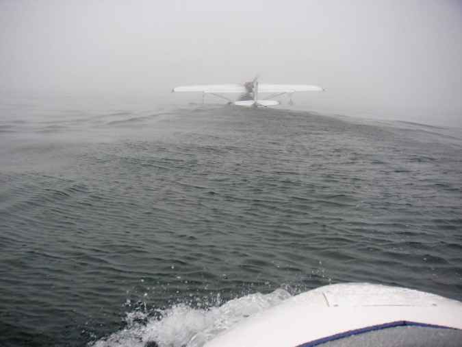
He also had two other gizmos that were useful: His depth finder told us we were approaching the shore long before we came close, so we were never in danger of running aground. And he used the marine-band radio in the canal to ask a boat driver to slow down so we could keep up in displacement mode where the swells were still in effect. He also used it to talk with a couple of marinas, asking about ramps and docks.

I've since acquired a marine radio, but am still not likely to get a ham license, even though you no longer have to learn Morse. A depth finder? Hmmm...


A CAVEAT ABOUT THIS ADVENTURE:  I don't want to seem to be recommending this kind of flying (and boating), and as I said above, I wouldn't have set out on it by myself. It was "The Viking's" experience and equipment that made it all go so smoothly.

On the other hand, I now know that, with proper preparation, a SeaRey is capable of doing a lot more than putting around over a lake or river on a clear, calm day. It really is a pretty good boat in open water, and boating is a lot safer than flying when the visibility goes down.

So one of the lessons of this adventure, for me at least, is that the third SeaRey mode--floating--is important to keep in mind.

It's a matter of mind-set: My tendency was to think of it as an airplane first and second as a car. But if anything it's inherently a boat first. And realizing that has radically changed the way I think about flying it.


Note:  "The Viking" has a real name, but I think he'd prefer anonymity.  Anyone who knows him will recognize him right away.


Back to "Learning Flying"
My home page .